Last week I was pleased to attend an excellent conference on James Logan and the Networks of Atlantic Culture and Politics, 1699-1751, co-sponsored by The Library Company, UPenn’s McNeil Center for Early American Studies, the Historical Society of Pennsylvania, and Stenton, James Logan’s home, now owned by the Colonial Dames. Logan came to Pennsylvania as William Penn’s secretary in 1699 and became one of the leading political figures in the colony, as well as a merchant, scientist, scholar and a few other roles to boot. If you haven’t been to Logan’s home at Stenton, I highly recommend a trip; right now is a particularly great time to go because as part of year-long temporary exhibition they have been able to borrow back items with Logan provenance from across Philadelphia (and beyond) and it is a real treat to see them in context.
The Rosenbach has a few Logan documents, mostly laid into our massively extra-illustrated copy of Lives of Eminent Philadelphians (which would makes its own interesting post). Here is a copy of a petition Logan submitted to the Pennsylvania council, asking for a salary, since he’d served for five years as clerk of the council and secretary of Pennsylvania without payment.
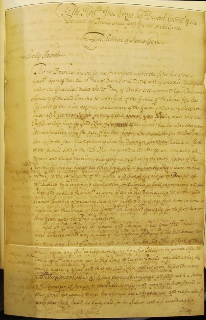 |
| James Logan, Petition: to John Evans. Philadelphia, 14 December 1705. A f.869liv v.8 p.664-5 The Rosenbach of the Free Library of Philadelphia |
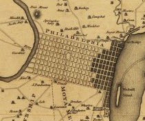
One slide that was de rigeur for a large number of presenters at the conference was the famous Scull and Heap map of Philadelphia and for those of you who aren’t familiar with this map, I thought it would be fun to post our copy. The Scull and Heap map was originally published in 1752, but continued to be reissued for years. Ours is a 1777 version.
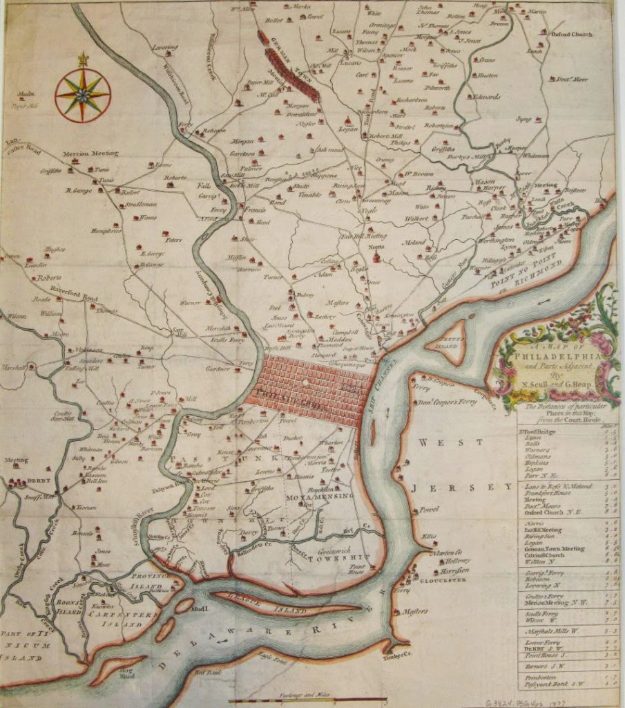 |
| A map of Philadelphia & parts adjacent by N. Scull & G. Heap. 1777. Map G3824 .P5G46s 1777 The Rosenbach of the Free Library of Philadelphia. |
Logan’s home, Stenton, appears near the top center of the map, slightly southeast of German Town. It sits about halfway between two major roads: York Rd. and Germantown Ave. You can see its original cupola (now gone) on the image.
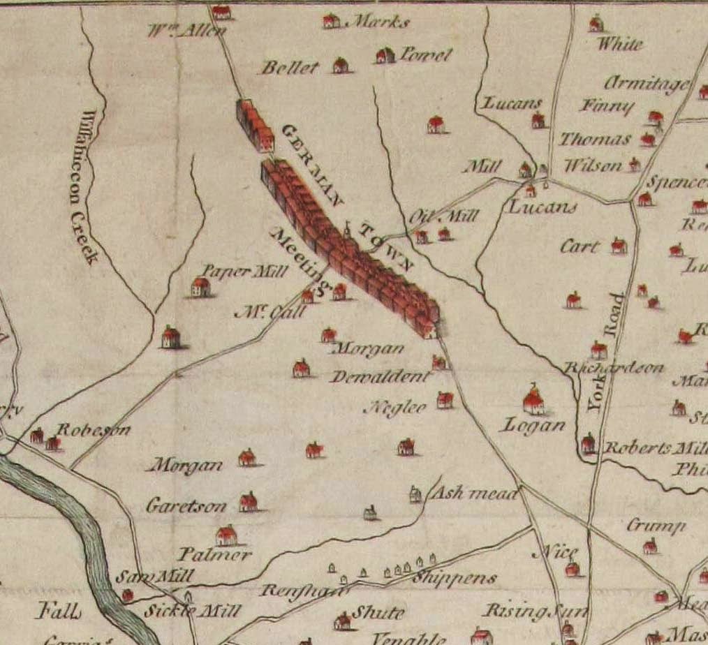 |
| A map of Philadelphia & parts adjacent by N. Scull & G. Heap (detail). 1777. Map G3824 .P5G46s 1777 The Rosenbach of the Free Library of Philadelphia. |
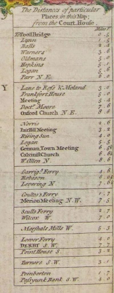
Here is the section of the map showing Philadelphia. The only building marked is the court house at second and market, from which all the distances on the map are measured.
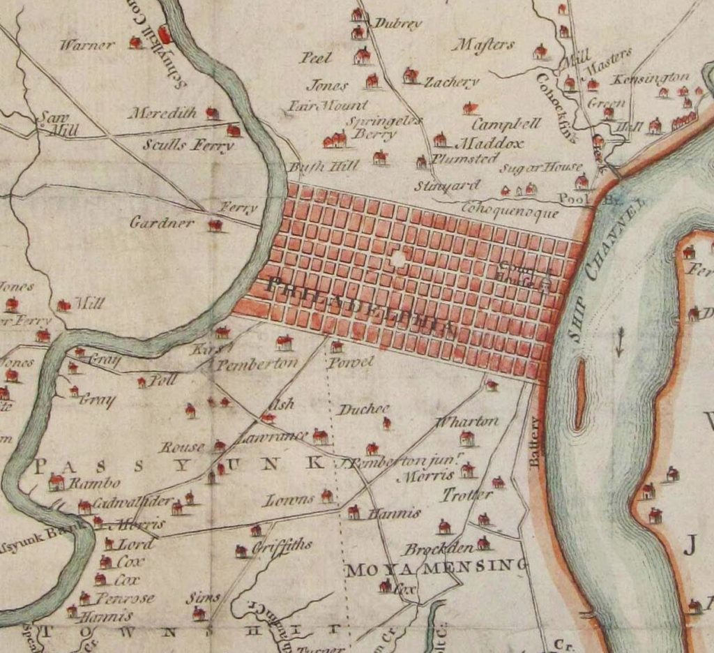 |
| A map of Philadelphia & parts adjacent by N. Scull & G. Heap (detail). 1777. Map G3824 .P5G46s 1777 The Rosenbach of the Free Library of Philadelphia. |
 |
| A map of Philadelphia & parts adjacent by N. Scull & G. Heap (detail). 1777. Map G3824 .P5G46s 1777 The Rosenbach of the Free Library of Philadelphia. |
The image of Philadelphia on the map was more theory than reality. It shows the fully
completed grid between the rivers, a la the original Holme plan, but in
reality development still clustered along the Delaware river. On this William Faden version of the map, also published in 1777, the shaded areas show what was actually occupied. The Rosenbachs’ home and surrounding areas west of Broad Street wouldn’t be settled until well into the 19th century.
 |
| A plan of the city and environs of Philadelphia, (detail). London, W. Faden, 1777. G3824.P5A1 1777 .S3 Library of Congress Geography and Map Division |
Those of you in Philadelphia or the surrounding suburbs may find it fun to find yourself on the map. I personally live in the area noted as “West Jersey,” although farther inland than the few riverfront settlements it depicts.
If you are interested in historic Philadelphia maps and other geographic resources you might want to check out the Greater Philadelphia GeoHistory Network and Philaplace. Enjoy!

Kathy Haas is the Associate Curator at The Rosenbach of the Free Library of Philadelphia and the primary poster at the Rosen-blog.